
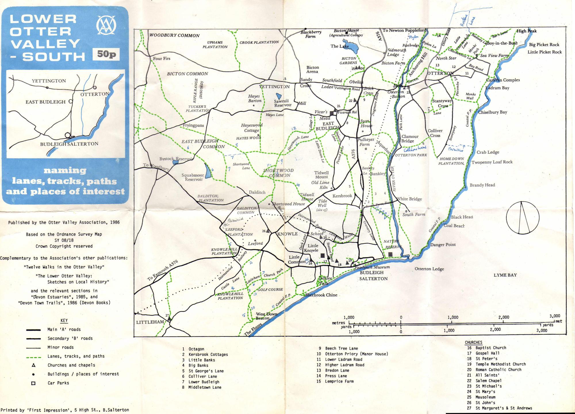
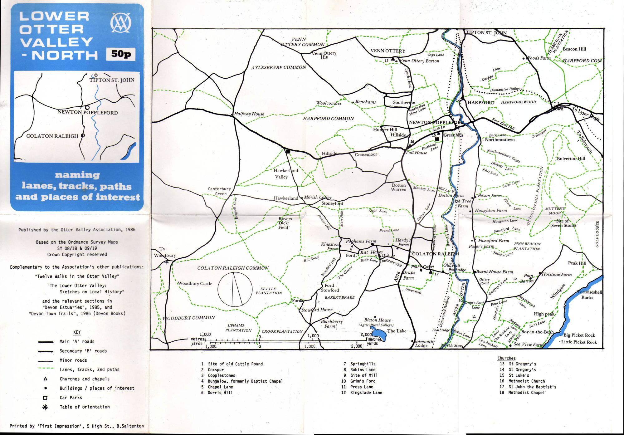
In 1986 the OVA produced two maps: Lower Otter Valley South and Lower Otter Valley North.
Click on each map to zoom
These maps were designed to be used in conjunction with the other OVA publications of the time; 'Twelve Walks in the Otter Valley' and 'The Lower Otter Valley: Sketches in Local History'.
These maps were simple sketch maps based on Ordnance Survey mapping but in addition they name many of the lanes, tracks and paths as known at the time. Since then some of these tracks and paths have been lost or the names have fallen from use. The maps are a useful historical guide to some of these old names.
Note the design of the OVA logo from that time.
These maps do not indicate rights of way; a modern Ordnance Survey map must be consulted for that purpose.
Martin Smith
July 2026